Target Population: World Geography
Learning Goals & SOL's:
WG.5 The student will analyze the characteristics of the regions of the United States and Canada by
a) identifying and analyzing the location of major geographic regions and major cities on maps and globes;
b) describing major physical and environmental features;
c) explaining important economic characteristics; and
d) recognizing cultural influences and landscapes.
Activity:
Students should be divided into small groups of 3-5, and each group should create one Google doc. Students will then be shown both of the images and asked to use Google, or any other search engine, to help them figure out the location of each picture. Groups will work together to type their answers in a Google doc. This allows for students to start the lesson with engagement and encourages students to think critically about a location. Students should be allowed 5-10 minutes for searching and questions.
Once groups have an answer they should share with the entire class, and the teacher should ask each group why and how they came up with their answer. After each group shares, the teacher should reveal the location if none of the groups answered correctly and the teacher should explain that the lesson will covering characteristics of the United States and Canada.
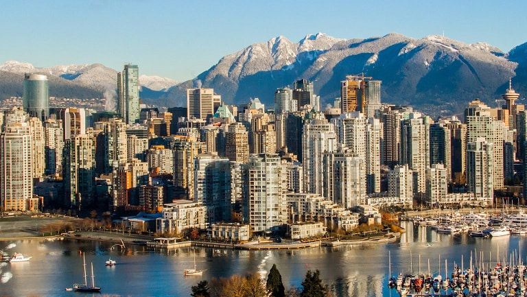
Vancouver, Canada

New York City, 11th Avenue (1910)
How did the online teaching environment influence your design decisions?
- The online environment encouraged me to use tools that I might not use if the lesson was being delivered in person. For example, if I was doing this activity in person, I would probably skip the Google docs.
Explain the design of the new activity using technology in relation to the TPACK framework
- This activity encourages students to think about geography through location and how humans impact the environment. For this activity I am more interested in the thinking process than I am for the actual information students are learning.
Referencing the SAMR Model, how are you using technology transformatively in the activity?
- This activity is only possible with technology because it requires students to use google to figure out the location of the image. Without technology this activity would not be possible.
